Severe Weather Ahead with Thunderstorms
Key areas of concern include flash flooding, difficult travel, and damaging wind gusts from the severe thunderstorms, with the weather expected to clear up by the holiday weekend, bringing partial clearing on Wednesday and a pleasant Fourth of July.
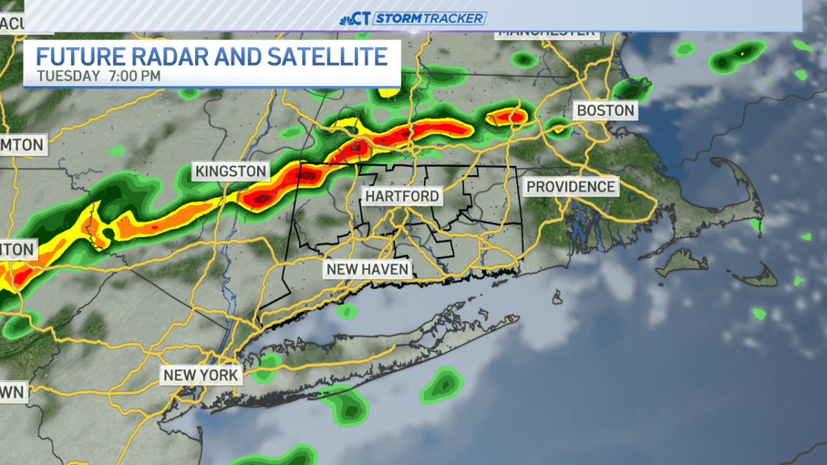
Southern New England is bracing for strong thunderstorms and heavy rain in the evening, with initial storms developing between 4-8 PM, potentially causing flash flooding and difficult travel. A weak wave of energy will trigger a localized line of heavy rain and thunderstorms, with one or two storms possibly becoming severe, accompanied by damaging wind gusts.
The storms are expected to weaken by tonight as a cold front arrives, bringing light scattered showers until midday Wednesday. However, the region can expect sunshine to return on Thursday, followed by another cold front in the evening, which will increase the chance of thunderstorms to 20%. The weather forecast for the rest of the week includes partial clearing on Wednesday and another chance for strong thunderstorms on Thursday.
Severe thunderstorm warnings have expired in Connecticut, but the state still faces a chance of scattered showers and severe storms through 9 p.m. on July 1, 2025. The storms, which affected most northern counties until 7:30 p.m., are moving out, but humidity has returned, increasing the likelihood of rain and thunder. Temperatures reached 90 degrees at Bradley Airport, with a heat index near 94.
The Fourth of July is expected to be pleasant and hot, with temperatures in the 90s inland and cooler near the coast, making for a nice holiday weekend after the anticipated thunderstorms. Residents are advised to stay updated with the latest weather forecast to plan their activities accordingly.