Severe Weather Alert: Thunderstorms Hit South Carolina
The severe thunderstorms are expected to bring strong gusty winds, frequent lightning, and golf-ball-sized hail, causing damage to properties and infrastructure. Residents are advised to take necessary precautions and stay informed about the latest weather updates.
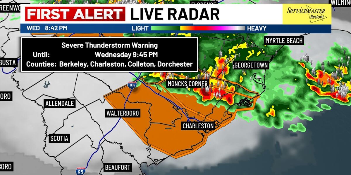
A Severe Thunderstorm Warning has been issued for the Lowcountry region in South Carolina, affecting areas including Walterboro, Saint George, and Charleston, with strong gusty winds and frequent lightning being the main threats. The warning is in effect until 10:30 p.m. for some areas and 9:45 p.m. for others.
The warning comes on top of a Severe Thunderstorm Watch that was issued for the region and is set to expire at midnight. A severe thunderstorm warning has been extended for four Lowcountry counties in South Carolina, including Colleton, Beaufort, Hampton, and Jasper, until 11:30 p.m. The storms are capable of producing golf-ball-sized hail, causing damage to roofs, siding, windows, and vehicles, as well as considerable tree damage and wind damage to mobile homes and outbuildings.
The National Weather Service issued a heat advisory for the Lowcountry counties, which expired at 8 p.m., but a second consecutive heat advisory was issued for the same area. The heat advisory is in effect through 8 p.m. Strong storms are possible in the Midlands on Wednesday night, prompting a WIS First Alert Weather Day. The entire WIS viewing area is under a Severe Thunderstorm Watch until midnight Thursday.
Residents in the affected areas are advised to stay indoors and avoid traveling during the warning period. A power outage tracker is available, and viewers can share photos of the storms using a gallery. The weather service will continue to monitor the situation and provide updates as necessary.