Severe Weather Forecast: Blizzard Hits Southern Minnesota
The winter storm is part of a larger system affecting the Plains states, with blizzard warnings stretching from Kansas to southern Minnesota, and residents are advised to take necessary precautions to ensure their safety, including stocking up on emergency supplies and having a plan in place in case of power outages or other disruptions.

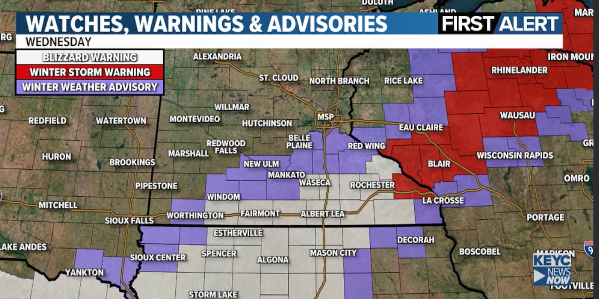
A powerful winter storm is set to bring heavy snow and strong winds to southern Minnesota on Wednesday, with a blizzard warning issued for parts of the region, including areas such as Waseca, Blue Earth, and Fairmont, and a winter weather advisory for the far northwestern edge.
The storm, which began at sunrise, is expected to taper by sunset, with heavy snowfall and strong gusty winds leading to white-out conditions, making travel extremely difficult, if not impossible, along I-90 and throughout the region. The Twin Cities metro area may see some rain or wintry mix, but is unlikely to accumulate much snow, while areas south and southeast of the metro could see up to 4 inches of accumulation.
The heaviest snow and strongest wind are expected in a narrow band stretching from northern Iowa to south-central Minnesota and into western Wisconsin, with snow totals ranging from 3-8 inches. The storm's track has shifted slightly south, downgrading the far northwestern edge from a Blizzard Warning to a Winter Weather Advisory, but a Blizzard Warning remains in effect for south-central and southern Minnesota.
Residents in the affected areas are advised to stay indoors and avoid traveling unless absolutely necessary, as the severe weather conditions are expected to persist throughout the day, and to check the latest weather forecast for updates on the storm's track and expected snowfall totals.