Critical Cold and Stormy Patterns May Grip Eastern US in January

A strong winter pattern is forecasted to hit the Eastern United States in January 2025, potentially ranking among the coldest months on record in the region.
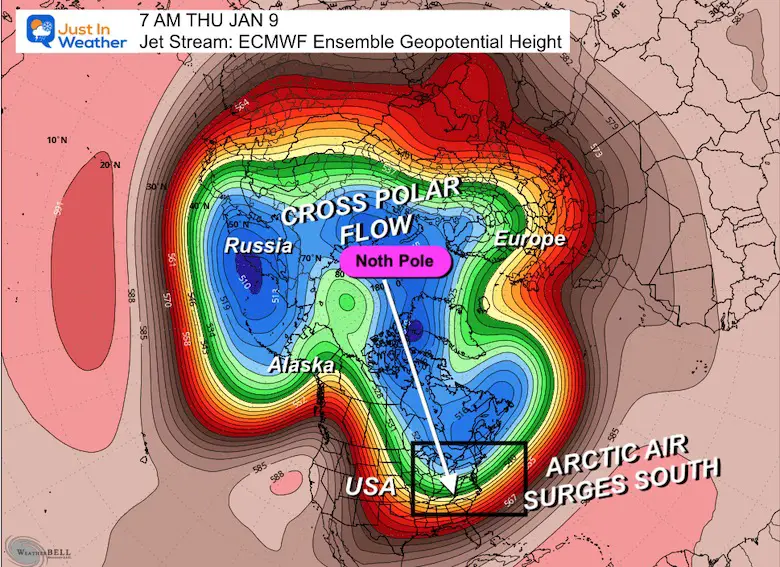
The atmospheric setup for this cold snap involves a complex interplay of various climate phenomena, including the Cross Polar Flow, Polar Vortex, Pacific North American Oscillation (PNA), North Atlantic Oscillation (NAO), and Madden-Julian Oscillation (MJO). Analog years dating back to the 1950s suggest that similar patterns have led to very cold weather and above-average snowfall in the past, including the record-breaking cold of 1977 and 2016.
The Polar Vortex is expected to fragment into multiple vortices, allowing arctic air to penetrate deeper into Eastern North America. This could lead to prolonged periods of freezing temperatures, with some areas potentially staying below average for up to three weeks. The ECMWF model predicts unusually cold temperatures in the Ohio Valley and Mid-Atlantics regions by January 9-10, with temperatures 20-30°F below average.
The National Weather Service has issued a warning for a January cold snap, with temperatures expected to plummet significantly. While there is uncertainty surrounding the second half of the month, the initial forecast indicates a cold pattern that will settle over the East, particularly in the first half of the month. The western United States, on the other hand, is expected to experience milder temperatures, with some areas potentially experiencing above-average temperatures by the end of the month.
As the winter season gains momentum, residents across the Eastern United States are advised to prepare for a potentially harsh and stormy January. Keeping a watchful eye on local weather forecasts and staying informed about the latest updates will be crucial for those bracing for the anticipated cold and precipitation-filled month ahead.